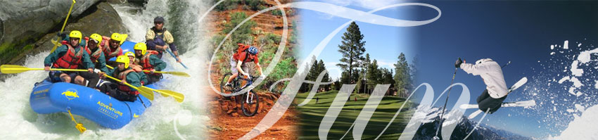
Things
To Do In Show Low, Arizona
The City
of Show Low, Arizona has a broad range of community facilities
including a municipal library, bowling alley, 18-hole golf
course (5 within a 15-mile radius), an archery range, a multi-screen
theater, and many athletic facilities. These athletic facilities
include an indoor aquatic facility, lighted Little League
softball and baseball fields, handball and basketball court
facilities, tennis courts and picnic areas.
If you're
looking for things to do while you are staying in Show Low,
look no further than the below assembled list.
Biking
In Show Low
Los
Burros Trail - Located within the White Mountains
outside of Pinetop Arizona, the singletrack of Los Burros
winds through old growth forest, a unique environment in the
state of Arizona. Damp and cool conditions are welcome relief
for bikers considering a mid-day summer ride.
Well maintained
and marked by navigational diamonds, the Los Burros trail
circumnavigates Wishbone Mountain, which rises to 8800’.
The trail is located within the Fort Apache Indian Reservation.
Camping is an option at the trailhead.
Length: |
14
miles |
Time
To Allow: |
2.5
hours |
Difficulty: |
Intermediate |
Trailhead
Elevation: |
7,850 feet |
Buena
Vista Trail - "Buena Vista” means “nice
view” in Spanish, and this ride is packed with plenty
of buena vistas. The Buena Vista Trail, a central piece of
the White Mountain Trail System, loops within a triangular
segment of a national forest. But to get to those nice views,
riders have to go up.
Buena
Vista’s defining aspect is its climbs. There are seven
significant climbs on this trail, the first being by far the
steepest and most strenuous. Cyclists shouldn’t be surprised
if they count more than seven climbs while riding the Buena
Vista: What mere mortal riders consider a lung-busting climb,
the high-altitude bike studs who frequent the trail simply
view as a short rise. And remember, what goes up always comes
down. There are few users on the trail (typically hikers and
ATV enthusiasts), so enjoy ripping downhills after each climb
(with caution).
Length: |
10.4
miles |
Time
To Allow: |
2
hours |
Difficulty: |
Intermediate |
Trailhead
Elevation: |
6,500 feet |
South
Pinetop (Springs, Blue Ridge, and Country Club Trails) -
The three loops in south Pinetop-Lakeside are an excellent
example of why people—not just retirees—are starting
new lives in the White Mountains. Just a mile away from condo
and housing developments resides Sitgreaves National Forest.
The first
really cool mountain biking route as you enter Sitgreaves
from Bucksprings Road is Trail 633, the Springs Trail. This
trail is an even mix of super-fast flat singletrack weaving
through pine and juniper forest, and tricky, technical passages
through rock gardens. Racers blasting through full-throttle
can finish the entire trail in about 45 minutes. However,
few riders will be able to ride this route without dabbing.
One switchback in particular is sure to kick off even the
most experienced riders.
Length: |
Many
options |
Time
To Allow: |
45
min to 3 hours |
Difficulty: |
Intermediate |
Trailhead
Elevation: |
7,200 feet |
[
top ]
Boating
In Show Low
Fool
Hollow Lake Recreation Area - A favorite area for
residents and visitors alike is Fool Hollow Lake Recreation
Area (pictured), which is operated by the Arizona State Parks,
located on the City's northern border. This Recreation Area
was created by a private/public partnership in 1988 between
the City of Show Low, U.S. Forest Service, Arizona Game and
Fish and Arizona State Parks and private entities, with construction
beginning in the fall of 1991.
It is
an 850-acre recreation area surrounding a 149 acre lake and
includes 92 recreational vehicle/camper hook ups, 31 developed
tent sites, five shower buildings with rest room facilities,
two handicapped fishing piers and a contact station. In addition,
a fully functional sanitary dump station, a fish cleaning
station and several tot lots are available to visitors with
the project. Plans in progress include group campgrounds,
nature center, amphitheater, two large grassy playing fields,
picnic ramadas, hiking trails and playgrounds. Annual use
permits are available through the Arizona State Parks, by
contacting (520) 537-3680.
Show
Low Lake - Operated by Recreation Resource Management
under contract with the City of Show Low, which offers campgrounds
and picnic areas, including a 75-site group campground area.
Show Low
Lake is located adjacent to Show Low Lake Rd about 1 mile
from Hwy 260. It is a 100 acre lake that sits at an elevation
of 6500 ft. Adjacent to the lake is Show Low Lake Campground,
a 75 site campground with some electric sites, dump station,
shower facility, and small convenient store. The store rents
boats, sells fishing licenses, bait, tackle, drinks and snacks.
The campground also offers a playground, day use ramadas and
group camping. For more information you can call the park
at (928) 537-4126 or for reservations, please call 1-888-537-7762.
[
top ]
Fishing
In Show Low
There
are numerous species available in the waters within the White
Mountains area perfect for fishing no matter what age. Below
is a list of beautiful lakes in the White Mountains with a
brief description of each.
| A-1
Lake |
Administered
By: |
Reservation |
Surface
Area: |
24
acres |
Elevation: |
8,900
feet |
Location: |
22 miles east of Pinetop off AZ 260 |
| Achires
Lake |
Administered
By: |
State/Federal |
Surface
Area: |
2
acres |
Elevation: |
8,600
feet |
Location: |
2 miles south of Hannagan Meadows, off US 191 |
| Becker
Lake |
Administered
By: |
State/Federal |
Surface
Area: |
85
acres |
Elevation: |
6,400
feet |
Location: |
2 miles northwest of Springerville off US 60 |
| Big
Lake |
Administered
By: |
State/Federal |
Surface
Area: |
450
acres |
Elevation: |
9,000
feet |
Location: |
10 miles southwest of Eager using AZ 260 & 273 |
| Bills
Lake |
Administered
By: |
Private |
Surface
Area: |
8
acres |
Elevation: |
6,000
feet |
Location: |
AZ 77 north of Show Low to White Mountain Lake Rd. |
| Bog
Tank |
Administered
By: |
Reservation |
Surface
Area: |
12
acres |
Elevation: |
8,100
feet |
Location: |
18 miles east of Pinetop across from Horseshoe-Cienega |
| Bootleg
Lake |
Administered
By: |
Reservation |
Surface
Area: |
10
acres |
Elevation: |
6,800
feet |
Location: |
3 miles south of Hondah, Rt. 73 |
| Becker
Lake |
Administered
By: |
State/Federal |
Surface
Area: |
85
acres |
Elevation: |
6,400
feet |
Location: |
2 miles northwest of Springerville off US 60 |
| Bunch
Reservoir |
Administered
By: |
State/Federal |
Surface
Area: |
44
acres |
Elevation: |
8,200
feet |
Location: |
1 mile north of Greer |
| Christmas
Tree Lake |
Administered
By: |
Reservation |
Surface
Area: |
41
acres |
Elevation: |
8,200
feet |
Location: |
5 miles south of Hawley Lake on reservation Rt. 26 |
| Concho
Lake |
Administered
By: |
State/Federal |
Surface
Area: |
60
acres |
Elevation: |
6,300
feet |
Location: |
10 miles west of St. Johns on Rt. 61 |
| Cooley
Lake |
Administered
By: |
Reservation |
Surface
Area: |
11
acres |
Elevation: |
7,100
feet |
Location: |
1 mile south of Hon Dah |
| Crescent
Lake |
Administered
By: |
State/Federal |
Surface
Area: |
130
acres |
Elevation: |
8,900
feet |
Location: |
41 miles east of Pinetop on AZ 260 & 273 |
| Drift
Fence Lake |
Administered
By: |
Reservation |
Surface
Area: |
16
acres |
Elevation: |
8,900
feet |
Location: |
3 miles southwest of Reservation Lake on Tr. Y20 |
| Fools
Hollow Lake |
Administered
By: |
State/Federal |
Surface
Area: |
149
acres |
Elevation: |
6,600
feet |
|
Location: |
4 miles off 260 on old Linden Rd and either 22nd/32nd
St |
| Fred's
Lake |
Administered
By: |
Private |
Surface
Area: |
2
acres |
Elevation: |
7,200
feet |
Location: |
1/4 mile south of 260 on Fir Ln |
| Rainbow
Lake |
Administered
By: |
State/Federal |
Surface
Area: |
80
acres |
Elevation: |
7,000
feet |
|
Location: |
1 block south of AZ 260 using either Rainbow Lake Rd or
Lake View Rd |
| Reservation
Lake |
Administered
By: |
Reservation |
Surface
Area: |
280
acres |
Elevation: |
7,200
feet |
Location: |
19 miles south of AZ 260 using AZ 273 & FS 116 |
| Show
Low Lake |
Administered
By: |
State/Federal |
Surface
Area: |
100
acres |
Elevation: |
6,500
feet |
Location: |
1 mile off AZ 260 on Show Low Lake Road |
| Sunrise
Lake |
Administered
By: |
Reservation |
Surface
Area: |
890
acres |
Elevation: |
9,100
feet |
Location: |
30 miles east of Pinetop on 260 and 273 |
[
top ]
Golfing
In Show Low
Show Low,
Arizona is the tourism hub of the White Mountains, located
175 miles northeast of Phoenix and 195 miles north of Tucson.
Situated in southern Navajo County, Show Low offers championship
golf courses for both leisure players and serious golfers.
Bison
Golf and Country Club, Bison Course
18 holes (Public) - (928) 537-4564
1 North Bison Preserve Drive
Show Low, AZ 85901
27 miles from the center of Show Low. |
Torreon
Golf Club, Cabin Course
18 holes (Private Non-Equity) - (877) 771-6771
651 Torreon Loop
Show Low, AZ 85901-2732
28 miles from the center of Show Low. |
Bison
Golf and Country Club, Show Low 2 Course
9 holes (Public) - (928) 537-4564
1 North Bison Preserve Drive
Show Low, AZ 85901
27 miles from the center of Show Low. |
Juniper
Ridge R.V. Resort, Juniper Ridge Course
9 holes (Public) - (928) 537-4805
1911 Juniper Ridge Resort
Show Low, AZ 85901-9514
35 miles from the center of Show Low. |
Torreon
Golf Club, Tower Course
18 holes (Private Non-Equity) - (877) 771-6771
651 Torreon Loop
Show Low, AZ 85901-2732
28 miles from the center of Show Low. |
Silver
Creek Golf Club, Silver Creek Course
18 holes over 6,813 yards with a par of 72 (Public) -
(800) 909-5981
2051 Silver Lake Blvd
Show Low, AZ 85901-8154
37 miles from the center of Show Low. |
[
top ]
Hiking
In Show Low
A full
trail system is in place providing areas where you can go
for a gentle walking or do some stenuous, heart pumping hiking.
The White Mountains Trailsystem is a system of twenty-five
to thirty interconnecting, multi-use, trail loops ranging
from the community of Vernon on the eastern edge and stretching
to the community of Clay Springs in the west.
A great
resource for additional information can be found by visiting
Pinetop-Lakeside
Tracks website.
| Bear
Wallow #63 |
Length
Roundtrip: |
16
miles |
Difficulty: |
Intermediate |
|
Trailhead
Directions: |
From
Alpine, drive 27.25 miles south on US 191 to FR 25. Turn
right and go west 3.1 miles to the signed trailhead. |
| Blue
Range Primitive Area |
Length
Roundtrip: |
25
miles |
Difficulty: |
Intermediate |
| Trailhead
Directions: |
From
Alpine go South on US 191 (formerly called US 666) for
23 miles to Hannagan's Meadow. Turn left on FR 29 and
go 1/2 mile to trailhead. Trailhead is accessible in a
car. |
| Bonanza
Bill Trail |
Length
Roundtrip: |
7.5
miles |
Difficulty: |
Beginner |
| Trailhead
Directions: |
From
Alpine, go East 3 miles on US 180 to FR 281. Go south
20.7 miles on FR 281 to Pueblo Park Road. Go East on Pueblo
Park Road for 4.7 miles to the well signed trailhead.
The trailhead is about 35 feet west of the Arizona-New
Mexico state line. |
| Chitty
Falls Loop |
Length
Roundtrip: |
18.25
miles |
Difficulty: |
Expert |
| Trailhead
Directions: |
From
Alpine drive south on US191 for 33 miles to the Strayhorse
campground. Park on the east side of US191 in the parking
lot. The trailhead is on the west side in the campground
by the closed road. |
| Country
Club Trail #632 |
Length
Roundtrip: |
4.5
miles |
Difficulty: |
Intermediate |
| Trailhead
Directions: |
From
the northern junction of US60 and SR260 in Show Low, travel
SE on SR260 through Pinetop-Lakeside about 13.25 miles.
Turn left on Burnside Road (now called Buck Springs Road)
and drive through the residential neighborhood about half
a mile to FR 182. Turn left and drive 2 miles. FR182 curves
left at this point. Before the turn is the entrance to
a development. Turn right into the development and make
an immediate left. The trailhead is 100 yards down a dirt
road. |
| Escudilla
#308 |
Length
Roundtrip: |
6
miles |
Difficulty: |
Intermediate |
| Trailhead
Directions: |
From
Alpine go north 5.5 miles on US 191 to FR 56. Turn east
on FR 56 and go 3.6 miles to Terry Flat. Take left fork
.5 miles past Tool Box Draw to trailhead. |
| Los
Burros #631 |
Length
Roundtrip: |
13
miles |
Difficulty: |
Intermediate |
| Trailhead
Directions: |
From
Show Low go east on SR 260 through Pinetop-Lakeside to
Mc Nary. Turn north in Mc Nary on the road to Vernon.
This road becomes FR 224. From McNary take FR 224 north
for 7.2 miles to the Los Burros Campground. The trailhead
is at the far end. |
| West
Baldy Trail #94 |
Length
Roundtrip: |
12
miles |
Difficulty: |
Expert |
| Trailhead
Directions: |
From
the Northern Junction of SR 260 and US 60 in Show Low
drive Southeast on SR260 (N. White Mountain Road) to SR273
(about 36 miles). Turn right on SR 273 and follow it past
the turn off to the Sunrise Ski Resort onto the Sitgraves
Forest. The trailhead is about 9.5 miles south of SR260
on the right side of the road. Trailhead is accessible
in a car. |
[
top ]
Off
Road Activities In Show Low
| Black
Canyon Trail |
Length: |
16.8
miles |
Duration: |
1.5
hours |
| Description: |
Black
Canyon Trail is a 16.8 mile point-to-point trail located
near Heber, Arizona and is good for all skill levels.
The trail is primarily used for off road driving and is
accessible from April until October. |
| Chevelon
Crossing Road |
Length: |
24
miles |
Duration: |
1.25
hours |
| Description: |
Chevelon
Crossing Road is a 24 mile point-to-point trail located
near Heber, Arizona and is good for all skill levels.
The trail is primarily used for off road driving and is
accessible from April until October. |
[
top ]
Skiing
/ Snowboarding In Show Low
For great
skiing and snowboarding the Sunrise Ski Park Resort is just
about 34 miles from Show Low. You can escape into the wilderness,
ski, mountain bike, enjoy our annual festivals and fish to
your heart's content on Sunrise Lake. Or you can simply look
out on some of the most beautiful land in Arizona. Summer
or winter, when you come to Sunrise Park Resort in the White
Mountains of Arizona, you'll find a land, and excitement,
you'll want to experience throughout the year.The resort is
owned and operated by the White Mountain Apache Indian Tribe.
The Sunrise Park
Resort's three mountains feature world class skiing with 65
spectacular runs that offer winter excitement for skiers of
all ages and skill levels. The resort's Express High Speed
Detachable Quad Chairlift can deliver sixteen thousand skiers
uphill per hour!
Families with young
children will appreciate the "ski-wee" section that
permits the little ones to learn to ski in a safer environment.
The TerrainPark offers skiers and snowboarders the chance
to show off their skills on a snow half pipe, wood and metal
rails, and a contained event space. For the cross-country
enthusiasts the Park features plenty of cross-country ski
trails.
If you
need gear, the Sunrise Rental Shop can provide your needs
from ski-gear rental to warm clothing for skiing comfort.
The service shop include gear repair, snowboards and skis
as well as skiing lessons and trail permits.
For additional
information, feel free to visit Sunrise
Park Resort website.
[
top ]
Whitewater
Rafting In Show Low
Salt
River Rafting (SRR) in White Mountains - SSR specializes
in running guided whitewater rafting trips on the Salt River
in Arizona. James, Mike and Wiley started as guides in the
early 1990's and now own the company they worked for.
SRR is
located just 2 1/2 hours from Phoenix and 3 hours from Tucson.
Undeveloped and unspoiled, the 2000' deep Upper Salt River
is the only commercially run class III and IV whitewater in
the Sonoran Desert of the United States. Saguaros, sun, scenery
and splashes are guaranteed with every trip.
For more
information visit Salt
River Rafting website or call (800) 425-5253.
[
top ] |